What Kinds of Wetlands are in NC?
North Carolina has many kinds of natural systems ranging from ancient mountains to barrier island beaches. Riparian (river) systems in our state range from babbling streams rushing through waterfalls and down steep slopes to slow, sediment laden rivers wandering across the flat coastal plain. We have wetland forests in the mountains that slope down to brackish marshes and cypress stands thriving behind the barrier islands. This diversity of hydrological and landscape features creates a diversity of wetlands, some unique to our state while some are shared with other parts of the country, continent and world.
 Riverine Forest Wetland
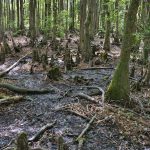
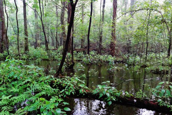
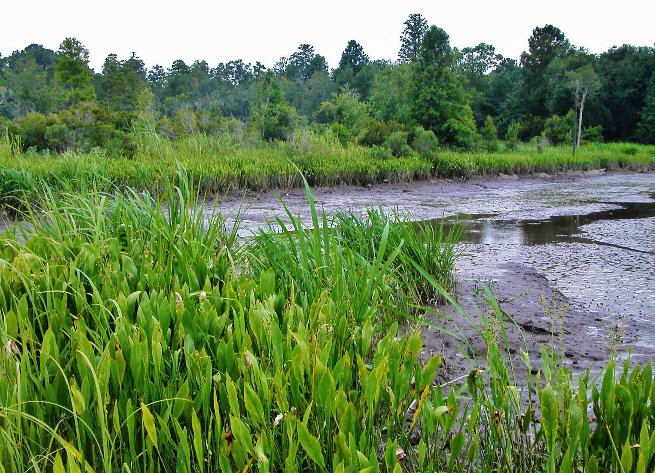
Riverine forest wetlands occur extensively in North Carolina, other southern states, and even in other countries. They occur throughout North Carolina along the floodplains of rivers, receiving much of their water from floods, but they also receive water from rain, surface runoff, and/or groundwater at or near the surface. Bottomland hardwood forests and riverine swamp forests are two riverine forest wetland types that often occur in close association with each other and can be difficult to tell apart. The size and vigor of these forests are tied to the condition of the river and its floodplain, so changing these systems can significantly alter the services these wetlands provide. Many valuable lumber species of trees are found in riverine swamp forests and bottomland hardwood forests including many kinds of oaks, elms, maples, and ashes. Water-tolerant trees like red maple, overcup oak, black gum, cypress, American elm, and Atlantic white cedar constitute the majority of the plant cover, though shrubs and non-woody plants are also found in these wetlands.
Large swaths of riverine swamp forests are found in the Coastal Plain, but significant tracts are also found in the Piedmont area of North Carolina, especially adjacent to large lakes and in low-lying areas along large rivers that can be flooded most, if not all, of the year with typical rain levels. Beavers are a major contributing factor in swamp forest creation. Swamp forests are important habitat for many birds, fish, and mammals. They are important places for maintaining plant diversity and providing habitat for young fish and crayfish. Riverine swamp forests may transition into bottomland hardwood forests further away from a river. Bottomland hardwood forests occur along second-order or larger streams and provide good water storage. They may contain floodplain pools and they may transition upstream into forested headwater wetlands.
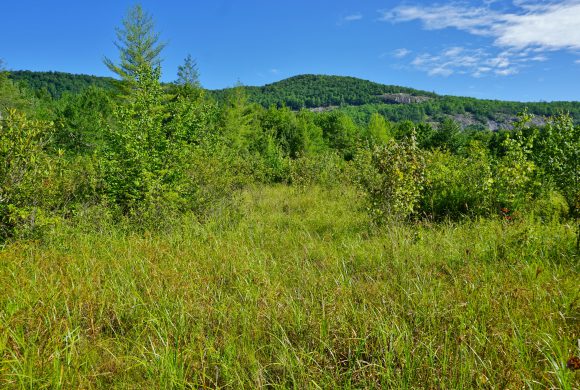 Mountain Bog
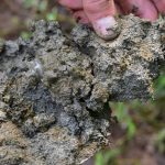
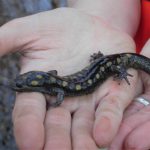
On the western side of North Carolina we find bogs. Bogs in North Carolina are mountain wetlands found in relatively flat spaces at the base of slopes, where long-term ground saturation makes an ideal situation for a range of wetland plants, many of them unique non-woody plants. Bogs are small; many are only one acre or less. The thick deposits of organic soils allow endangered plants like mountain sweet pitcher plant, green pitcher plant, swamp pink, and bunched arrowhead to grow, as well as unique wildlife like the endangered bog turtle. Bogs also support extensive mats of sphagnum moss, in accumulations not found in other natural landscapes. Walking in a bog feels like walking or bouncing on a wet sponge. Only 20% of North Carolina’s prehistoric bogs still exist in their unaltered condition, because many have been ditched or filled for farming.
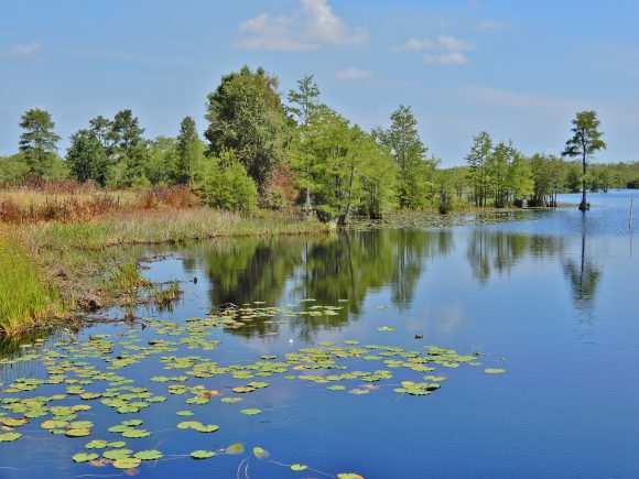 Carolina Bay
Carolina bays are not a wetland type per se, but they are unique, mysterious, isolated, elliptical landscape features found in the Coastal Plain. There are many of them in North Carolina and, along with open water, they can also contain a variety of wetland types (e.g., pocosins, freshwater marsh, cypress swamp). The name “Carolina Bay” comes not from the location of the wetland in relation to water, but from the consistent presence of bay trees (loblolly bay, swamp bay, and sweet bay). These large and small oval depressions in the landscape are not associated with streams or other water bodies, and they are all oriented in the same northwestern direction. Their origin is a mystery, but many theories have been proposed. Their primary source of water is precipitation during the winter and spring months. In the summer, the water in the shallower bays often dries up, making these wetlands excellent habitat for amphibians and reptiles in particular. The temporary nature of the wetland reduces the number of predators and aids in the amphibian reproduction cycle. In addition to amphibians and reptiles, many other species of animals find refuge in the wide variety of plant life in Carolina Bays. The plants, many of which are rare or endangered, benefit from the deep, rich soil. A large number of these wetland treasures have been severely altered and/or converted for farming. Watch our video featuring Carolina Bays here.
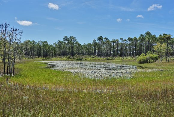
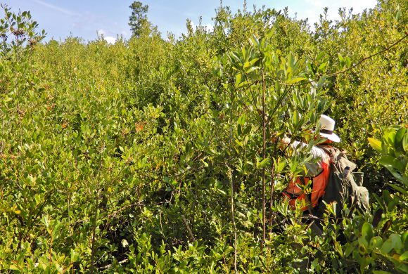 Pocosin
Pocosins are unique to the southeastern portion of the Atlantic coastal plain with the majority of them occurring in North Carolina. The word “pocosin” (pronounced puh-koh-sin) derived from native American words for this type of wetland. Pocosins develop in areas where ancient river valleys were filled in with sand, silt, and clay from the eroding Appalachian Mountains to the west. Over thousands of years, dead plant matter accumulated in these wet, low places, building up in slightly elevated formations. Because of their landscape position, these areas do not naturally have streams flowing into them but may instead have small streams flowing out of them. Pocosins can be a very demanding place for plants to grow. The water is acidic, low in nutrients and only replenished by precipitation. Very few kinds of trees can survive in a true pocosin, one of them being the gnarly pond pine. Evergreen shrubs grow very densely in pocosins and include a variety of bays and ti-ti. Very few of the grass-like plant species or non-woody plants we are used to seeing in wetlands are found in pocosins, and the pocosins can be very difficult to walk through because they are so dense. Pocosins once covered much of the eastern third of our state but many of them have been converted to agricultural land by removing water through ditching.
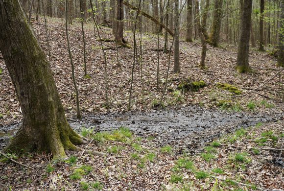 Seep Wetland
Seep wetlands are so named because the groundwater “seeps” to the surface. They are typically located along slopes leading down to floodplains and are characterized by the presence of slow-moving groundwater that is unable to permeate the underlying clay or bedrock and is being discharged to the surface. The soil is saturated for most, if not all, of the year, but there is usually not enough water to flow and form channels in a seep. The vegetation can range from small non-woody plants to large hardwood trees, and wildlife is varied as well. Salamanders often find refuge in seep wetlands.
 Basin Wetland
Basin wetlands are those found in natural depressions surrounded by uplands, usually less than a few acres in size. Lime sink wetlands in the Outer Coastal Plain are a good example. Some may have fairly steep sides and some have gently sloping sides. Rainwater collects in these depressions and creates temporary or permanent pools. Many dry out for much of the year, but they provide important breeding areas for amphibians, as predatory fish typically don’t live there. Basin wetlands can look like marshes with no trees, or like swamps with trees and shrubs, depending on factors like fire, water duration, and soil types. What makes them unique is their shape and setting within the landscape.
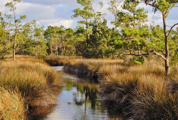
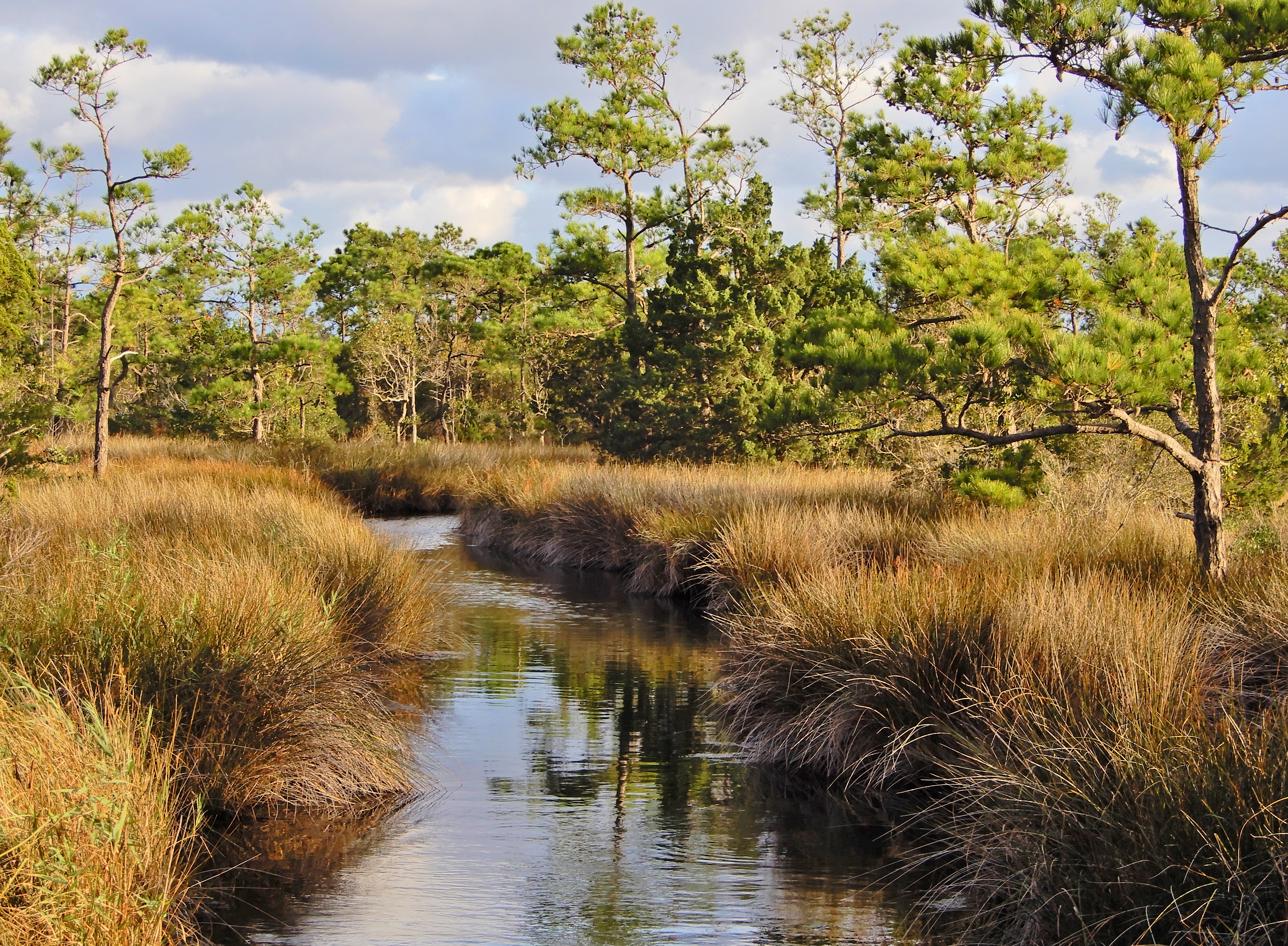
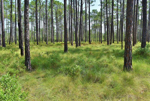 Pine Wetland
Pine wetlands (pine flats or pine savannas) are a type of forested wetland found in sandy soils of the coastal plain states including North Carolina. Water table levels in these wetlands stay close enough to the surface of the ground to foster a variety of water-tolerating plants, including pond pine trees, shrubs, and herbs. Other plants that can survive in these conditions include bays, fetterbush, gallberry, wax myrtle, sedges, orchids and lilies. Pine savannas are dominated by longleaf pines standing over a groundcover of grass and herbaceous plants and are dependent on cycles of destruction and regrowth from forest fires. This natural influence keeps non-native species out and allows the diversity of native species, including rare species like the Venus fly-trap and Schweinitz’s sunflower to thrive. The valuable longleaf pines have been extensively logged in North Carolina, drastically reducing the area of natural savannas to about 5% of their original extent. Many pine flat wetlands can still be found, as they are usually altered successors of previous savannas, swamp forests or are active pine plantations (logging farms). Pine flat trees are typically loblolly pines and slash pines, though other pines and hardwoods, like maples, may be found in them as well. Natural pine wetlands in our state harbor many interesting animals including the red-cockaded woodpecker, pine barrens treefrog, pine snake, gopher frog, and fox squirrel.
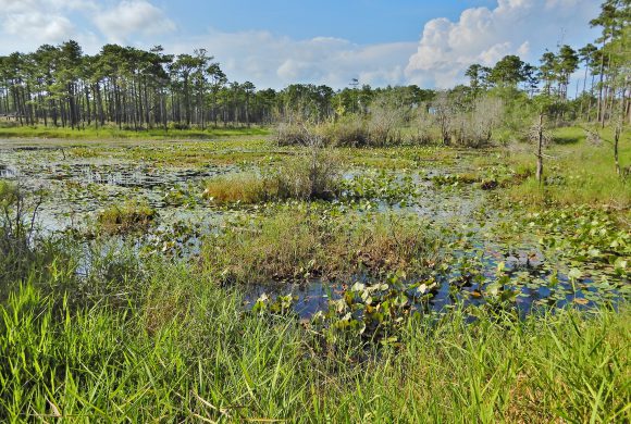 Freshwater Marsh
Freshwater marshes can be found in a wide variety of wet landscape contexts including along rivers, canals and estuaries, along lakes or ponds, along the base of wet slopes and in ‘wet meadows’ (relatively flat areas where the groundwater table is naturally close to the ground surface). Marshes generally do not have trees. They have a wide variety of small, non-woody plants like cattail, rush, sedges, and soft-tissued flowering plants with broad leaves. Many times, freshwater marshes are a result of disturbances, such as forest fire, utility line maintenance, or beaver activity changing streams to ponded areas. The deep organic and mineral soils are continuously saturated, if not flooded, enabling thick deposits of plant material to accumulate. Marshes are enormously important to our state, controlling flood damage during storms and hosting important wildlife including birds, mammals, and commercial fish species.
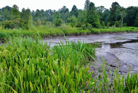 Tidal Freshwater Marsh
Tidal freshwater marshes are a type of freshwater marsh found only in the Coastal Plain, in areas where they experience flooding by lunar and wind tides and during temporary high wind storms. These marshes are predominantly freshwater, so salinity is typically low (< 0.5 parts per thousand), and they support a large diversity of herbaceous and some woody plants. “With the exception of the Cape Fear River, North Carolina’s large coastal rivers drain to sounds rather than to the open ocean. Consequently, tides in these rivers are small in magnitude, resulting in limited tidal flooding and a small area of tidal fresh marsh in comparison to other Southeastern States.” (Jerad D. Bales and Douglas J. Newcomb, U.S. Geological Survey for U.S. Geological Survey Water-Supply Paper 2425)
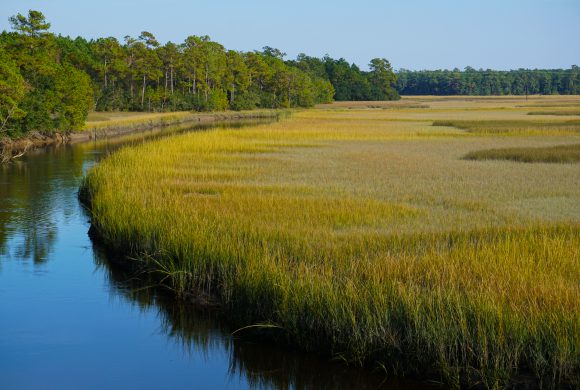 Salt/Brackish Marsh
Salty ocean tides provide regular flooding of saltmarshes and brackish marshes. If a marsh receives the right mixture of freshwater and saltwater, it will be brackish (salinity of 0.5 to 30 parts per thousand). Brackish marshes are often dominated by black needle rush, while saltmarshes (salinity greater than 30 ppt) harbor species like salt cordgrass and oyster grass. Both types of coastal marsh are very important nursery grounds for commercially important fish and shellfish. They also help absorb wave energy during storms.
 Estuarine Woody Wetland
Estuarine woody wetlands are coastal, found at the edges of estuaries or saltmarshes. Their water levels are a bit unpredictable since they are affected by wind tides and occasional flooding from salt or brackish water. The plant life found in these wetland types is primarily woody vegetation including trees and large shrubs. Common trees are loblolly pine, cedars, red maple, and sweetgum, with common shrubs of wax myrtle, saltbush, and marsh elder. These trees and shrubs are able to adapt to changing water levels and chemical influences from saltwater.
Note:
These are major wetland types found within North Carolina. Other variants and subtypes of these do exist in more restricted extent, an example being maritime forest wetlands which occur only on our barrier islands. Additionally, different groups will divide our wetlands into more categories, such as the 16 wetland types used by the NC Wetland Assessment Method (NC WAM) for permitting purposes, and many more classifications used by the NC Natural Heritage Program. The 11 major wetland types we list are a simplified version of these many classifications.